 VN
VN
 EN
EN
06/07/2026, 02:00
Business economics
Maximising effectiveness of transportation pillar in “river city”
In the context of overloaded road infrastructure, effectively exploiting the river network, focusing on the Sai Gon River and connecting routes to Dong Nai and the Mekong Delta, can create a “double leverage” for economic growth and reduce urban traffic pressure in Ho Chi Minh City.
Therefore, in its strategy for developing multimodal transport infrastructure, the city is striving to unlock the enormous potential of its inland waterway system.
Creating a new value chain
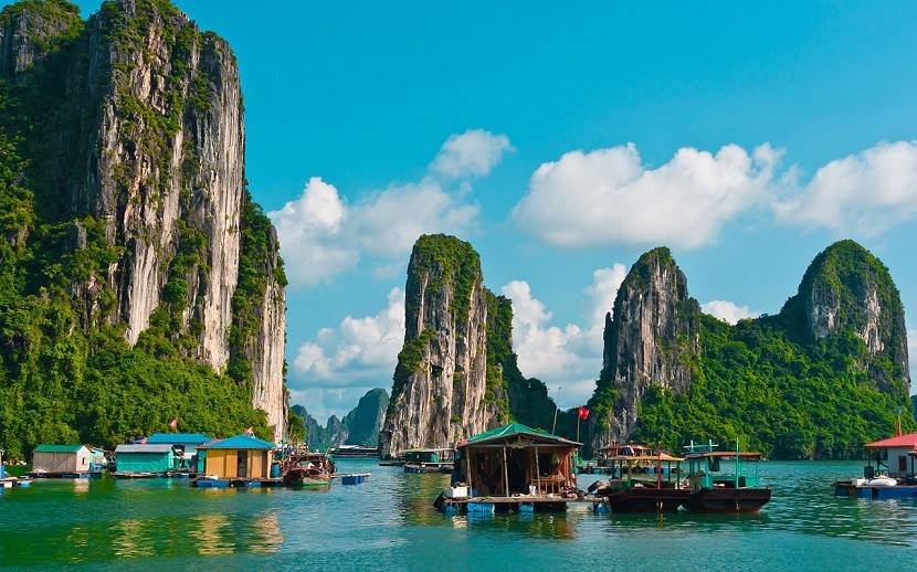
Ho Chi Minh City possesses an inland waterway network (rivers, canals, and streams) with a total length of approximately 1,450 km, placing it among the cities with the densest waterway systems in the country. The system includes major rivers such as Sai Gon, Dong Nai, Nha Be, and Long Tau, creating enormous potential for the development of freight transport and waterway tourism.
The city also boasts the largest seaport system in the South, with the Cai Mep-Thi Vai international port complex, along with a well-developed system of piers serving tourism, such as the Cau Da pier and the Vung Tau-Ho Chi Minh City high-speed ferry terminal (Bach Dang pier). These geographically advantageous factors have contributed to the sustainable development of the inter-regional logistics transportation system.
According to Nguyen Ngoc Khanh, Director of Tay Nam ICD Port One-Member Limited Liability Company, currently, the company transports approximately 750,000 TEU of goods annually from large ships at Cai Mep-Thi Vai port to Truong Tho port and vice versa, with a steady annual increase of 10%.
Transporting these containers by road via National Highway 51 to Ho Chi Minh City would incur additional costs and delays due to traffic congestion, and would be particularly inefficient in terms of travel time. This is a significant advantage for waterway transportation, which logistics businesses are actively leveraging.
According to logistics businesses, waterway freight transport is typically 30-50% cheaper than road transport, making it suitable for large-volume goods such as construction materials, agricultural products, and containers.
If waterway transport routes connecting Ho Chi Minh City with Dong Nai and the Southwest region are well-organised, it could significantly reduce pressure on major arterial roads like National Highway 1 and the Ho Chi Minh City-Trung Luong Expressway. Simultaneously, the inland container depot (ICD) and inland waterway terminals will effectively “share the load” with seaports.
Along with freight transport, passenger transport combined with tourism development has created significant potential, as Ho Chi Minh City has implemented many unique models over the years, contributing to GDP growth from its “river city” model.
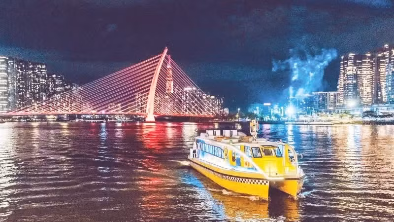
For example, the No. 1 River bus route (Bach Dang-Linh Dong), operating on the Sai Gon River since November 2017, has attracted millions of passengers for sightseeing and tourism, contributing to reducing localised pressure on road traffic on the central-eastern axis.
Nguyen Kim Toan, Director of Thuong Nhat Limited Company - the unit managing and operating the Bach Dang - Linh Dong River bus route – shared “After 8 years of operation, the route is expected to serve 820,000 passengers in 2025, representing a significant leap, a 100% increase compared to the first year of operation, and fostering a habit of using waterway transportation among city residents. This shows that if we properly utilise the waterway system, it will bring economic value, especially enhancing the scenic value of Ho Chi Minh City’s waterways.”
Ho Chi Minh City currently has 11 maritime routes and 101 inland waterways with a total length of 913 km. To maximise this potential, the city has developed over 60 waterway tourism programs, including 7 regular tours and more than 15 newly introduced tours. These waterways have created unique tourism products, deeply rooted in the city's culture and history.
A comprehensive waterway development strategy is needed
After expanding its development space and strengthening regional connectivity, Ho Chi Minh City’s waterway transport system not only serves the inner city but also plays a crucial role as a “soft backbone” connecting the Southeast and Southwest regions. In reality, the level of exploitation remains very modest. Waterway transport and tourism activities only account for a small proportion of the city’s transportation and service structure.
Planning experts share that a significant reason limiting the effectiveness of river bus routes in particular, and waterway tourism in general, is the insufficient investment in the system of wharves and piers according to the plan, reducing passenger accessibility and limiting the service area of the route. After 8 years of operation, only 7 out of 9 wharves have been invested in, and these wharves are still operating temporarily due to incomplete legal procedures regarding land use...
In addition, many other limitations are major obstacles preventing the waterway infrastructure from being properly “unlocked”, such as the lack of synchronised wharf infrastructure and its connection with modern logistics; some low bridges restricting the passage of large vessels; and a lack of multimodal connectivity between waterways, roads, and seaports...
According to architect Ngo Viet Nam Son, if infrastructure is invested in comprehensively, the Sai Gon River will become the “backbone” of waterway transportation, creating a combined journey of work, tourism, and entertainment connecting various regions. Most importantly, the city must prioritise infrastructure investment first (docks, piers, dredging of waterways, etc.) and then develop commerce and services afterward.
One of the key efforts to invest in and improve transportation infrastructure is for Ho Chi Minh City to raise the clearance (a technical solution to increase the height of the bridge’s underside, the distance from the water surface to the bridge's underside, by raising the span or renovating the structure) of vital bridges.
The city has prioritised allocating 200 billion VND to raise the clearance of Binh Trieu 1 and Binh Phuoc 1 bridges, resolving a long-standing bottleneck that has seriously hindered waterway transport and prevented many large cargo ships from navigating.
According to the Director of the Department of Construction, Tran Quang Lam, the city views waterway transport as a new pillar of growth. Therefore, raising the clearance of Binh Trieu 1 and Binh Phuoc 1 bridges is seen as a commitment to regional development, ensuring the synchronised exploitation of this important waterway. In the long term, the city will build and implement solutions to develop waterway transport in a way that integrates with the logistics system, seaports, and ICD ports.
The city will implement several solutions to increase waterway transport capacity in the 2026-2030 period, such as: encouraging investment and the formation of inland waterway terminals serving public passengers in the Bach Dang and Nha Rong-Khanh Hoi areas.
In the northern area (the Cu Chi and Binh Duong areas before the merger), the goal is to complete at least one inland waterway port for cargo transport, one inland waterway port for passenger transport, and one dry port to effectively utilise the Central-Northwest and Central-Northeast development axes. At the same time, the city will continue to develop public passenger transport routes by waterway to share road traffic, especially on central axes and inter-regional connecting routes...
Ho Chi Minh City does not lack potential, but it still lacks a sufficiently strong and synchronised strategy for exploiting waterways. When the waterway system is properly invested in, it will not only be a solution to reduce traffic congestion, but also become a new pillar of growth, an “economic flow” connecting the city with the entire Southeast region and the Mekong Delta.
Author: NDO
RECOMMENDED TOPICS